Minnesota’s lake maps help you catch fish
By C.B. Bylander
Apr 08, 2019
Take advantage of Minnesota DNR topographic maps. You can find topographic maps for nearly 4,500 Minnesota fishing lakes on the agency’s website. Learn more.
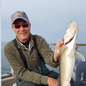
Have you ever seen fishing boats clustered in one area yet few anywhere else?
There’s a reason for this, and the reason relates to what’s invisible to the naked eye: underwater points, ledges, saddles, humps and holes.
Yet you too can find these prized fishing destinations by simply downloading a topographic lake map from LakeFinder on the Minnesota Department of Natural Resources website or using its interactive mapping function on Mobile LakeFinder.
What is a topographic lake map?
Basically, it’s a drawing of the lake bottom. The map depicts gradations in water depth via squiggly lines that correlate to the contours of the lake’s bottom. Topographic maps are especially valuable when you know your location in relation to, for example, a deep hole or a weedy hump or a shallow flat where schools of minnows are likely to attract feeding fish.


Thanks to Mobile LakeFinder you can easily discern your on-lake location. That’s because LakeFinder uses your smartphone or other mobile device to chart your location while on the lake.
- Map lines depict water depths in increments of five feet or less. Lines close together mean a sharp change in water depth, such as a drop-off or underwater bluff. Lines far apart indicate areas of little change in water depth.
- Good fishing spots can vary by season, time of day, species and other factors. Still, good fishing areas tend to be:
- Points that deepen as they extend into the lake. These often look like triangles on the map.
- Humps surrounded by deeper water. These often look like circles or ovals on the map.
- Holes surrounded by shallower water. These often look like circles or ovals, too.
- Flats and the edges of flats adjacent to deeper water.
- Saddles (deeper water of a consistent depth between two points or humps).
The beauty of a topographic map is that you can study it at home. This allows you to identify preferred fishing spots before you even launch your boat or pull on waders. You can also show a printed map to friends or others whose advice you value. Experienced anglers will often pull out a pen, circle the spots they’d likely fish and wish you the best because that’s how they learned too.
Use our interactive map to find places to fish and boat near you. And get your fish on!